--The BEST Outdoor INFORMATION in the Southeast!--
# 20 - Chicken Creek
-with the Santee River & Wambaw Creek-
Rated: Moderate
9.1 miles, one-way
Get ready for variety with this paddle! You'll
spend time on the Santee River, meander two
wilderness bottomland creeks that rarely see
visitors, paddle through the Francis Marion National
Forest, and experience the same forests that
Revolutionary soldiers traversed over two
-centuries ago. Besides all this, you're likely to
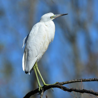
-see herons, egrets, bald eagles and so much more!

Difficulty: Moderate, only due to distance.
Distance: 9.1 miles, one-way.
Time: 4 - 5 hours.
Crowds: Light. You could see motorized boat traffic on the Santee River sections, but the creeks rarely see boats or paddlers.
IMPORTANT: Requires staging 2 vehicles or arranging pickup.
Put In: McConnell’s Landing (note: some mapping/GPS applications call this “Pleasant Hill Landing),
Forest Service Road 204-F, Jamestown, SC 29453. GPS: 33.244908, -79.520938 or 33°14’41.7”N, 79°31’15.4”W.
Take Out: Wambaw Creek, Elmwood Recreation Area, Echaw Road, Jamestown, SC 29453. GPS: 33.207819, -79.468563 or 33°12’28.2”N, 79°28’06.8”W. PHOTO of BOAT RAMP.
For Francis Marion National Forest ALERTS: click HERE.
Fees/Permits: None.
Current: Flows downriver in a southeast direction.
Tidal Influence: Yes, tide is approximately 2 – 2.5 hours behind Charleston Harbor tide table. Charleston Tide Chart, click HERE.
Trees Down or Other Obstructions? If you come across downed trees, limbs or other obstructions while paddling
this blueway, please let us know. We can often facilitate removing it. Contact us at 843-433-0361 or 843-719-4146.
Precautions: It’s advisable to wear bright orange during hunting season in the Francis Marion National Forest.
Water Level: This Blueway paddle trail is approximately 2 hours behind the Charleston tide. This can affect your effort paddling the creek. Charleston Tide Chart, click HERE.
So Much History Nearby: Did you know Berkeley County has more than 110 historical markers and historical points of interest? CLICK HERE to find your Adventures in History!
Weather on the Trail: Click HERE


