--The BEST Outdoor INFORMATION in the Southeast!--
# 16 - Upper Wadboo Creek
-Francis Marion National Forest-
Rated: Easy to Strenuous
3 - 5 miles, round-trip, one-way
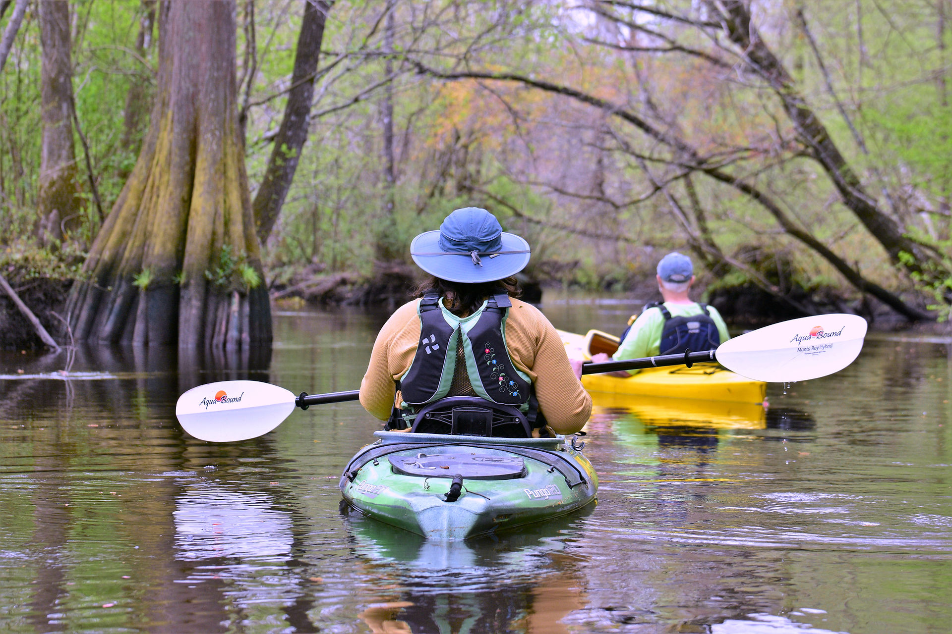
One of the most beautiful paddles in the state,
the historic Upper Wadboo Creek is a lovely
cypress swamp that looks the same as it did
two centuries ago when Francis Marion roamed
these parts. You'll see remnants of 19th century
rice plantations dikes and canals, large limestone
-bluffs and the fauna include white tailed deer,
-turkey, osprey and ibis.


Difficulty: Easy to Strenuous. Read important note below.
Distance: Varies, from 3 - 5 miles.
Time: Plan a minimum of a couple hours to enjoy this gem of a paddling route.
Crowds: Light.
IMPORTANT! READ !! The "Upper Wadboo Creek" blueway was originally created to highlight the 5 miles between the stepped kayak launch located at the Henry Brown Bridge in the national forest off Patts Road down to the Rembert C. Dennis Landing. This of course requires staging 2 vehicles or arranging pickup if doing this trip. Very few people ever attempt this on an annual basis and the extreme upper creek most likely has log jams and other obstructions that will require many portages. We do not recommend trying this unless you are a very experienced paddler. Please reach out to us before attempting. But don't let this discourage you (read on).
99.9% of paddlers launch from the Rembert C. Dennis Landing (listed as the "Take Out" below) and paddle UP stream as far as they can. (Upstream: when leaving the boat ramp, paddle to the left, away from the bridge/road crossing.) You'll see a great variety of the swamp by doing this. You can reliably get at least 1.3 - 1.5 miles upstream, but possibly a lot further depending on water levels. This is highly recommended, is considered one of the most beautiful paddles in the State of South Carolina and is the most popular route in our Blueways program! All of the photos in the gallery below are from these 1.5 miles. It's stunning!
Put In: Patts Road, Moncks Corner, SC 29461. Park at end of dirt road and there’s an easy to find path leading to Palmetto Trail on the southeast side of the parking area. The launching ramp/Henry Brown Bridge is a 300-yard portage down the trail. GPS for Parking Area: 33.255451, -79.916218 or 33°15’19.6”N, 79°54’58.4”W. GPS for Actual Ramp/Bridge: 33.253937, -79.913003 or 33°15’14.2”N, 79°54’46.8”W.
***Take Out (this is recommended for "Upper Wadboo"): Rembert C. Dennis Landing, 1400 SC HWY 402, Moncks Corner, SC 29461. GPS: 33.195955, -79.953198 or 33°11’45.4”N, 79°57’11.5”W.
For Francis Marion National Forest ALERTS: click HERE.
Fees/Permits: None.
Current: Runs downstream, southwest direction.
Tidal Influence: Yes! Approximately 3 - 3.5 hours behind the Charleston tide table. Charleston Tide Chart, click HERE.
Trees Down or Other Obstructions? If you come across downed trees, limbs or other obstructions while paddling
this blueway, please let us know. We can often facilitate removing it. Contact us at 843-433-0361 or 843-719-4146.
Precautions: Obstructions or water levels that require portaging are the biggest concern. After big storms, downed trees and low hanging branches will have to be negotiated. It’s advisable to wear bright orange during hunting season.
Water Level: Check the Tailrace Canal (Cooper River) discharge rate. It should be below 5,000 cubic feet per second. Tailrace Canal Discharge Rate, click HERE.
Weather on the Trail: Click HERE
Paddling Through History: Further down Wadboo Creek in August 1782, the British military attacked Brig. Gen. Francis Marion and his militiamen. Marion beat back the British attack. Shortly after this skirmish, the British abandoned South Carolina. Francis Marion went on to make Wadboo his headquarters.
So Much More History Nearby: Did you know Berkeley County has more than 110 historical markers and historical points of interest? CLICK HERE to find your Adventures in History!


