--The BEST Outdoor INFORMATION in the Southeast!--
# 27 - The Northern Isles
Rated: Moderate
7 - 10 miles
Located approximately 1 mile above Church
Island on Lake Marion, The Northern Isles
consist of two islands (Pine Island and Bass
Island) and several other large cypress fields.
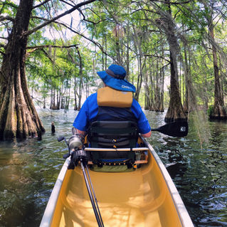
You'll paddle through acres and acres of
otherworldly cypress and tupelo trees, see
-the large waterfowl that the Santee Cooper
-Lakes are known for, and have several
-opportunities to get out and stretch your-
-legs or have lunch on a small sandy beach.

Difficulty: Moderate.
Distance: 7 - 10 miles, round-trip, based on how much exploration you do.
Time: 3 - 5 hours.
Crowds: Usually very light boat traffic.
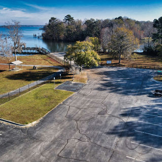
Put In / Take Out: Spiers Landing Boat Ramp, 1505 Spiers Landing Road, Cross, SC 29436. GPS: 33.395937, -80.197160 or 33°23’45.4”N, 80°11’49.8”W. Directions: If you search “Spiers Landing Boat Ramp,” all
GPS mapping applications recognize this location. PHOTO of BOAT RAMP.
Current: If you get out into the open water, east of the islands, there could be a small current in the south direction.
Tidal Influence: None.
Trees Down or Other Obstructions? If you come across downed trees, limbs or other obstructions while paddling
this blueway, please let us know. We can often facilitate removing it. Contact us at 843-433-0361 or 843-719-4146.
Precautions: You’ll have protection from some winds with the islands, however, there are plenty of open spaces in Lake Marion where winds can intensify resulting in waves/whitecaps.
Water Level: For this Blueway paddle trail, water level is not much of a concern because of open waters. Lake Marion Water Levels, click HERE.
So Much History Nearby: Did you know Berkeley County has more than 110 historical markers and historical points of interest? CLICK HERE to find your Adventures in History!
Weather on the Trail: Click HERE


